

The ultimate app for Geography/Geology amateurs and professionals."
- Mel Martin, TUAW.com
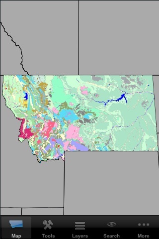
Geology MT is the edition of the popular GIS (geographic information system) covering the state of Montana. It is a self-contained application (no Internet or cellular access required) that contains a vast amount of information about the geology and geography of the Treasure State. Using the iPhones GPS, it enables you to navigate the state and get a much better understanding of your surroundings, identify geological formations, mines, quarries, rivers, etc....
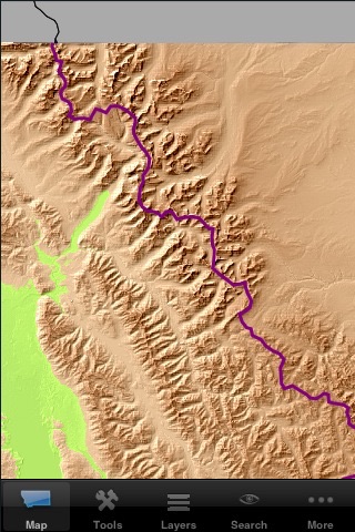
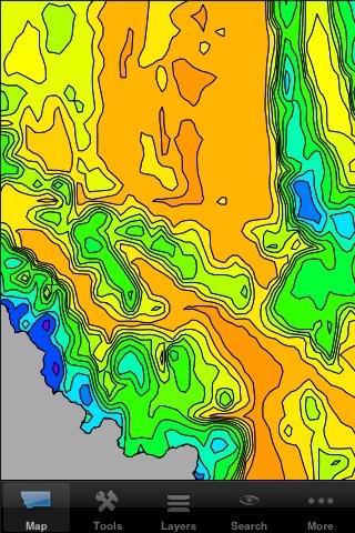
This release contains 30 layers, which can be combined in any desired way:
- states outlines
- the complete geological map from USGS
- terrain elevation
- zip codes
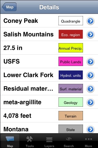
- almost 33,000 named features (summits, tunnels, cliffs, bridges, etc...)
- fire history
- annual precipitation
- all 625 earthquakes in recorded history over 3.0 magnitude
- seismic hazard
- over 10,000 mineral resources
- active mines
- quaternary faults
- old faults
- public land ownership
- continental divide
- glacial boundary
- hydrologic units
- EPA ecological regions
- USGS quadrangles
- township and range
- urban areas
- counties
- hydrology
- roads and major streets
- railroad tracks
- cities and towns
- over 800 potassium/argon dates
- state plane zones
- UTM zones
- main aquifers
Each layer contains additional information about each feature. For instance, the geology layer has a description of the units name, age range, rock type, and description. Each mine has a name, a commodity, a facility type, and a company name. See our web site for more information about each layer.
Although this is a professional-quality tool, it can be used by anyone interested in their environment.
There have been a few improvements since the release of the sister programs covering CA, TX, NY/NJ/CT, FL, WA/OR, AZ, CO, UT, NV, NM, and ID. A new layer (continental divide) has been added.